Buses, trains and trams: Pittsburgh public transit guide
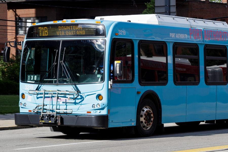
Pitt students can hop on any 61 or 71 bus heading inbound along Fifth Avenue, and they’ll be in Downtown within 15 minutes.
June 30, 2019
With Oakland parking scarce and few alternatives to get around the City, many Pitt students utilize the public transportation system in Pittsburgh, run by the Port Authority of Allegheny County, to move around. ID cards provide all students with free access to the buses, light rail lines and even the inclines that go up the steep hills along the southern border of the City — all you have to do is tap your card against the scanner at the front of the transit when you get on, and you’re ready to ride.
While the Port Authority can get you to your destination, understanding the web of routes that criss-cross through Oakland can be difficult. But once you understand the system’s layout, you will be ready to catch a bus and speed away on a trip.
Getting around Oakland
Let’s face it: when it gets cold, few people have a hankering to trudge through feet of snow to get to an 8 a.m. lecture.
Fortunately, there are many alternatives to walking to get around campus. Each 61 and 71 bus — there are four “branches” of each — provides connections between the westernmost point of campus, near Magee Women’s Hospital, and the easternmost point, by Craig Street. Similarly, the 58 and 93 travel along the Boulevard of the Allies into South Oakland, giving students a needed connector between so-called “deep South Oakland” and Central Oakland.
But Port Authority buses aren’t Pitt students’ only options for getting around within Oakland — Pitt itself offers many shuttles that provide convenient transportation to oft-visited locations around campus. The most popular, the 10A and 10B, stop outside the Cathedral of Learning in the middle of campus and provide connections to upper campus residence halls, like Sutherland Hall, as well as the gym, pool and rock climbing wall at Trees Hall. In addition, the 20A and 20B offer service to nearby Shadyside, while the 30A, 30B and 30C shuttles provide easy access to South Oakland, and the 40A gets the nerdier of us to the Biotech Center, located along the Monongahela River.
Getting to Downtown
Downtown has a lot to offer to Pitt students, with multiple entertainment halls for concerts and musicals and a beautiful state park with a large fountain all located within Pittsburgh’s “Golden Triangle.” PNC Park, the stadium for the Pirates, and Heinz Field, the stadium for the Steelers as well as the Pitt Panthers, are directly across the Allegheny River, only a quick walk away.
That’s why easy, quick, frequent access to Downtown is so crucial. Pitt students can hop on any 61 or 71 bus heading inbound along Fifth Avenue, and they’ll be in Downtown within 15 minutes. For students living on upper campus, they also have the option of catching the inbound 83 bus near the Fitzgerald Field House, which travels through the Hill District and enters Downtown near PPG Paints Arena, which doubles as the City’s hockey arena and an entertainment venue.
Getting to the East End
Neighborhoods east of Oakland — collectively known as the East End — offer a diverse set of opportunities for dining, entertainment and shopping. What’s even better for Pitt students is that these neighborhoods are quickly accessible by bus.
Squirrel Hill, a predominantly Jewish neighborhood located just past Carnegie Mellon University’s campus and Oakland, is accessible from any of the 61 buses. You can hop on any of the buses from the stop just outside Hillman Library, at the corner of Forbes Avenue and Bigelow Boulevard, and get off at the corner of Forbes and Murray avenues. Once there, you will have access to many restaurants and coffee shops within a short walking distance.
If Squirrel Hill doesn’t do it for you, Shadyside is an alternative. Catch any of the 71 buses at the corner of Fifth Avenue and Bigelow Boulevard and you can quickly get to Walnut Street, a hotspot for restaurants in between Fifth and Centre avenues. For grocery shopping, the 71A or 71C will get you to Giant Eagle and Aldi located at the corner of Centre and Negley avenues. And if you need a Target run, you can take either the 71C or 75, both of which stop near the red bullseye marking the store.
Getting to South Side
South Side is a neighborhood frequented by 21+ students due to the high concentration of bars. But it also offers a restaurant scene that first-years can take advantage of, such as the Hofbrauhaus and the Cheesecake Factory, as well as SouthSide Works Cinema, a movie theater.
It’s easy to get there, too. The 75, as well as both the 54C and 54D — which travel the same route towards South Side — leave from the corner of Fifth and Thackeray avenues and head across the Birmingham Bridge to East Carson Street. From there, most restaurants are within walking distance.
Getting to Pittsburgh International Airport
One bus particularly relevant for students traveling from far away is the 28X. The 28X is the only public transit in Pittsburgh that provides a direct connection from Oakland and Downtown to the Pittsburgh International Airport, located 20 miles west of the Cathedral of Learning. It runs every 30 minutes and can pick students up at the Fifth and Thackeray avenues stop, across the street from Litchfield Towers. Taxi services sometimes charge $30 or more for trips to the airport, so many students prefer to take the bus instead.
Whether you’re trying to explore the city or just enjoy a bite at your favorite place outside Oakland, Pittsburgh public transportation can get you to where you need to go.


